Lyke Wake Walk
by Yann 09/11/2012 · Featured / Trail Off
Approximately 40 miles or 65km across the North York Moors National Park very tops, from west to east, Osmotherley to Ravenscar, finishing almost in the North Sea, without any assistance.
A family challenge !
After doing the 3 peaks Walk (see more here) in 2010, the Lyke Wake Walk came to me naturally as the next run to do. Ever since I’ve been able to walk I have been hearing about this walk which has become a family challenge. All started in 1967 when “little Frank” who had just started working decided to do it in late September after having read about it during the summer. He arrived exhausted after getting lost in the very last part but that started it and soon he did it again with “big Frank”. Marian, Stephen, Julie, Linda and Christian all finished it in the next few years. At the time the LWW was quite popular and a sponsored walk going from East to West collecting funds for the rescue team was organized. The time Linda finished it was one of them, for example, and they celebrated Julie’s 18th birthday at the end of it, in Osmotherley near the reservoir.
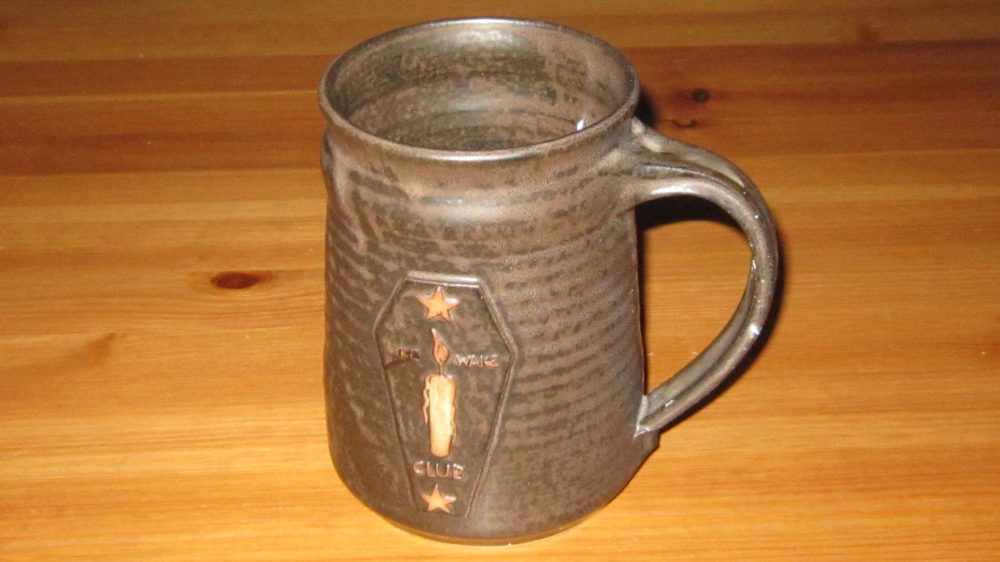
The mystique surrounding the LWW came from funny names I have been hearing like “Old Margery”, “Face stone” or “Fat Betty”. Famous stories, well known among us, also added to it like the time big Frank, during a break suddenly said “How nice it would be to have a cool beer right now!” The next moment, as all the others were already salivating for a nice cold, frothy beer, he brought out of a nearby bush, cold bottles of beer he had carefully hidden the day before! Christian had told me about this long stretch of railway he found boring. And his beer tankard (mug), Mac bought him in Ravenscar, in a small cafe at the end, has always been proudly hanging behind his bar.

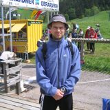
For my attempt, Frank and Glenda are helping me. On Thursday, Frank and I spend quite some time poring over different maps laid out in front of us. I am taking notes on the photocopies I’ll be taking with me whilst he is reviewing the tracks on Google maps and going through the book by Bill Cowley edited in 1975. Glenda is keeping a close eye on the weather forecast. It is supposed to be dry until 2 pm, the main showers coming over the Yorkshire dales from the west. We decide I should start at 8:30 the next day so I can avoid rain and dark as much as possible.
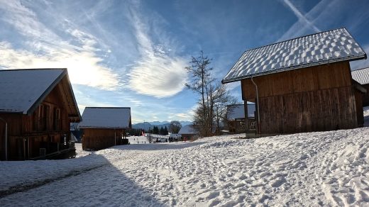
It is in fact 8:10 when I set off up the slope leading to Scarth Wood. At the top, at the first fork, my route normally goes right but I go left for 200 yards (180m) to go and get to the trig point that symbolizes the start point. That must be it, behind the wall. I climb over and up on the trig point looking around. I am so pleased. This time I am on my way at long last. As I am happily descending Scarth wood on a good track, I imagine all of them going down several years ago. I feel well too after having carefully rested for the last few days.
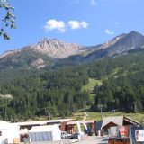
Now, I have to concentrate on the route, my GPS in one hand and the photocopy of the OS map in the other. The first part follows the Cleveland way which is well sign posted. No mention of the LWW at all of course as this walk has never been officially recognized as a long distance walk. I go through Coalmire, and down a lovely patch of grass where sheep are grazing with hardly any track at all. Up on Live moor, the wind is strong but mostly coming from the south so that is ok. It is really nice up here with views all around. Down and up again on Cringle Moor. A stone bench at the top facing the valley shows the high point. Until now it has been easy running apart from slippy stones going down which add to the fun more than anything else! The tracks are still easy to find too, my legs are still good so I am getting on quite fast on the whole. Up on Cold Moor I am careful to choose the path that goes over the Moor, through the Wainstones, these big, strange rocks that involve a bit of scrambling.

I cross the road and hestitate a bit but the correct path is the one well sign posted going up Urra Moor. I get on to the wider track Frank told me about and am now looking out for Hand Stone and Face Stone. I eventually come up to a stone, go round it, cannot really see a hand on it but suppose it is Hand stone. A few yards later, I spot another stone with a large smile on it and have no doubt this is Face Stone. My first bottle of water, I have around my waist, is empty so I replace it with a full one I have in my bag which relieves a bit of discomfort I was just starting to feel underneath one of my straps, not used to carrying so much weight in it. I check my watch so I can evaluate how much I have drunk. 600ml in 2h11, that is what I was planning to drink in an hour! I have 3 liters left so that should be enough for at least 6 hours.
I soon get, without really noticing, onto the railway. I do not find it boring and it is such easy going that I am surprised when I get to the turnoff for the shortcut. There is no track, and things get difficult. Navigating with the GPS, I have heather up to my knees preventing me from running. Never mind, I’ll just walk, no hurry. Oh good, the heather stops but a second later I have my feet wet and have to go round pools of water. I get to on a track but it stops 20 yards later. This is hard work, but eventually, I get to the road with Old Margery by its side. I go straight across but soon I am pretty sure I am losing my way again when suddenly here she is! I jump the ditch to go and kiss Fat Betty and go on, along the road. It takes several attempts to send my first message to my following team because of the reception not being too good.
The next part is the boggiest part according to Frank. I go past the Paved Causeway. It is indeed boggy but I am finding it ok when suddenly, I go down nearly to my waist, hands in the mud !!! Wow, it is boggy! Stones with white paint on the top are showing the way. I am happily strolling down the side of the track in the peat hag and find it quite easy after all. In the far distance, I can already see RAF Fylingdales which becomes my next objective.
[
RAF Fylingdales is a Royal Air Force radar base station on Snod Hill in the North York Moors, England. Its motto is “Vigilamus” (translates to “We are watching”). Its primary purpose is to give the British and US governments warning of an impending ballistic missile attack. A secondary role is the detection and tracking of orbiting objects.
]
Before the road, I know I am going wrong a bit but prefer to stay on this nice track and follow the road a bit to get back on track. Apparently, I am not the only one to choose this option. As I get onto the road I see the first (and last) LWW sign post saying “LWW in 200 yards”.
As I get to Wheeldale Moor, although it is supposed to be a bit better here, I find it quite tiring as it is still slippy and I avoid the track as it often has water on it. I constantly need to concentrate on my feet, so I cannot look out for Blue Man-i’-Th’-Moss (standing Stone) properly but suddenly I get to what I think must be it although it is not blue anymore… Big and little Franks who spotted it from a distance were saying it had blueish colors when they realized, getting nearer, that it had been painted in blue!
It’s going down now, it’s easier. I cross the road then go down a steep slope above a lovely small valley with a farm on my right to Wheeldale beck and the stepping stones nicely displayed. Hitting Howl Moor on the other side, I slowly make it to Simon Howe, pass the Railway and, as I cannot find a proper path, head straight for the road and its car park where some parties have people meeting them. I send my second text message to Glenda and get a quick reply asking for my estimated time now. Humm, there are roughly 13km left to go but as I had planned, the next part, following Little Eller Beck, is boggy and lacks a real path so I answer it would take me another hour and a half approximately. I eventually get to Lilla Cross a really nice stone and, from there on, the track gets easier. all of a sudden, looking ahead, I see a large blue patch that stretches out in the east. The sea! How nice and satisfying! And it does not seem a long way away either! I am now happily cruising along the side of the track, still avoiding the water on the path, smiling as the first drops of rain fall on me. Nothing nasty and I should be getting to Ravenscar without even getting my headlight out!
I can already see the main road going from Whitby to Scarborough when I fall down a steep slope leading to Jugger Howe Beck. Now this is where I go wrong. After the wooden bridge, I follow a good track on my right but my GPS soon shows I am wrong and I should be going in the opposite direction as this path does not lead anyway (checking back home on Google maps, it does!). I turn round and I am soon struggling in water and deeper heather at the bottom of a small valley. It’s exhausting! After a bit, I decide to go straight up and I’ll see what’s next when I get up there. What a nice surprise to see the paved road Frank had told me about at the top.
I get to the main road, and follow a good track, opposite, with the aerial at the end marking the small road going to Ravenscar. Joining it, I make a right and a left. Now heading straight to the sea, I get a little emotional passing the Ravenscar signpost. Frank is there with the camera. Hug. Then Glenda a bit further on. I want to go the official finish, the Ravenscar Hall Hotel, so they follow me in the car for 2min. I am so pleased. I’ve done it!
The small cafe in Ravenscar where they bought their handmade beer tankards does not exist anymore. However, Marian kindly gave me Frank’s. Thank you so much! What an honor! So the next evening, I shared a Landlord beer in it with little Frank to celebrate!
40 miles – 65 km – 1500 m D+ – 7h40min